|
| Hike occurred on October 13th, 2013 |
Vermont Appalachian Trail section hike
By "Timex"
Sunday, October 13th:
VT-9, Woodford, VT to Greylock Community Club, North Adams, MA
18.4 total miles for the day - rough map completed after the fact.
Mountains climbed: Harmon Hill (2,325 ft), Consultation Peak (2,840 ft), Eph's Lookout (2,254 ft).
Summary: I started the hike from the USFS parking lot on VT-9 (Molly Stark Trail) at 10:15am. I climbed Harmon Hill and got a picture of the view.
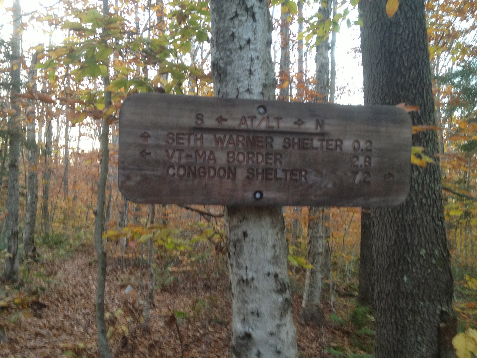
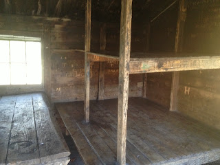
After a few more miles, I arrived at Congdon Shelter.
While a bit old, the shelter was quite nice and looked like it would comfortably sleep 8. The privy was new and very nice. Between Congdon and Warner shelters, I went by a very nice beaver pond.
 |
| View of Scrub Hill |
I also went underneath some power lines which provided an excellent view (sans wires).
I arrived at the Seth Warner shelter at 4:15pm. I set up my bed roll in the shelter and made dinner.
As I was eating, I turned on my phone to see if I could get signal. I found a message from my Monday morning ride, indicating they were unable to provide me with a ride. This change of plans meant that I had to pack up and continue hiking into North Adams, as no one I knew was available on Monday. I set out at 6pm to hike the ~7 miles.
I eventually passed by the VT/MA border, which is where the Long Trail begins.
After following along Sherman Brook for over a mile, I finally crossed it and walked into town.
From there, it was a few minutes walk to get to Greylock Community Club. I arrived at 9pm and met up with my ride. Since it was the weekend of the Greylock Ramble, there was quite a lot of festivities.


 After a few more miles, I arrived at Congdon Shelter.
 While a bit old, the shelter was quite nice and looked like it would comfortably sleep 8. The privy was new and very nice. Between Congdon and Warner shelters, I went by a very nice beaver pond.


 I arrived at the Seth Warner shelter at 4:15pm. I set up my bed roll in the shelter and made dinner.
 As I was eating, I turned on my phone to see if I could get signal. I found a message from my Monday morning ride, indicating they were unable to provide me with a ride. This change of plans meant that I had to pack up and continue hiking into North Adams, as no one I knew was available on Monday. I set out at 6pm to hike the ~7 miles.
  I eventually passed by the VT/MA border, which is where the Long Trail begins.
 After following along Sherman Brook for over a mile, I finally crossed it and walked into town.
 From there, it was a few minutes walk to get to Greylock Community Club. I arrived at 9pm and met up with my ride. Since it was the weekend of the Greylock Ramble, there was quite a lot of festivities.