Thursday, September 29, 2016

Fall AT section hike, day #6

Thursday, September 29, 2016
Start: Hughes Gap/TN 1330
End: US 19E/Mountain Harbour hiker hostel
Miles: 21.4

This morning, Mike dropped me off to Hughes Gap (4040') around 7:30am. I started up the trail and climbed up to Toll House Gap (6212') and walked past the side trail for Roan High Knob Shelter (6193'). From there, I went down to Carvers Gap/TN 143/NC 261 (5512'). I made amazing time and arrived around 10:15am. I tried to call Towanda to let her know I was there early but I couldn't get enough service to call so I waited until she arrived at 10:45am.

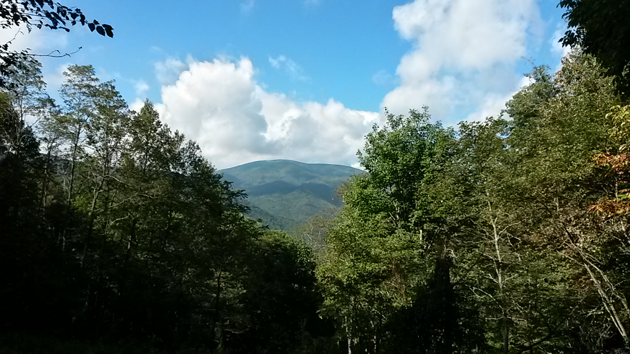
We started up the trail by ~11:15am. We climbed Round Bald (5813') and Jane Bald (5790') and then descended past Stan Murray and Overmountain Shelters (5045' & 4657'). From there, we climbed up Little Hump Mountain (5459'), down to Bradley Gap (4950'), and then up to Hump Mountain (5587'). On our way up Hump Mountain, we had a little bit of rain and a lot of fog and wind. After we summitted and started to go down, the wind blew the storm away and gave us some nice views. We then proceeded to race the storm to the hostel. We descended past Doll Flats and the NC/TN border (4600'), and down to US 19E (2895'). From there, we walked the 0.3 miles to the hostel, arriving at 6pm.

We snagged 2 of the remaining 3 hostel spaces. Towanda managed to convince someone at the hostel to drive us into town to get pizza, and let everyone order something if they wanted to. I took care of the money details and figuring out who owed how much. I was able to shower and do a load of laundry. I checked on my food supply and I have enough to get me to Damascus, provided I either get some snacks for the last day at a campground on my last night before town or pay a hostel in town to bring me to town a day early and then slackpack me. We shall see how I feel! Currently have lovely weather outlooks and I'm feeling pretty solid. Towanda will hike with me for a few miles in the morning tomorrow before heading back to US 19E to get a ride back to her car at Carver Gap.

Wednesday, September 28, 2016

Fall AT section hike, day #5

Wednesday, September 28, 2016
Start: Hughes Gap/TN 1330 (Cantarroso Farm)
End: Indian Grave Gap / TN 395
Miles: 21.2 (+0.3 for water, +0.8 for going the wrong way at Hughes Gap)

This morning, Mike gave me a 6:30am shuttle up to Hughes Gap, a solid hour out of town. On the way, we stopped at Hardee's and I got an egg and cheese biscuit. At the Gap, we were hard pressed to figure out which way was NOBO and which was SOBO. We ended up picking wrong, as I discovered 0.4 miles later when I hit a NOBO landmark and had to turn around. As it happens, the SOBO section there is direct compass north. So I was on trail and headed south by 8am. I made amazing time and arrived at my final destination by 4:30pm.

I climbed from Hughes Gap (4040') up to Little Rock Knob (4918') where the view were still restricted by clouds and mist that hadn't cleared at that point. I passed by Clyde Smith shelter (4496'), a campsite (4134'), and Greasy Creek Gap (4034'), before climbing Rock Pillar (4434'). I descended to Iron Mountain Gap/TN 107/NC 226 (3723') and then climbed to Little Bald Knob (4337'). I passed by Cherry Gap shelter (3988') and Low Gap (3900') before climbing Unaka Mountain (5180'). Unaka's peak was entirely dense evergreen forest; it was beautiful. From there, I descended to a piled spring and USFS 230 (4115') and then hiked through the Beauty Spot Gap (4323'). The Beauty Spot was amazing - the views were spectacular.

From there, the ~3.5 miles to Indian Grave Gap/TN 395 (3350') were all downhill and smooth sailing. My ride into town, Peggy, picked me up at 4:45pm, a good 45 minutes before I anticipated being picked up. She graciously dropped me into town and went back to the mountain to go out for a 45 minute hike like she'd originally planned.

Tomorrow, I'm currently planning a ~20 mile day, meeting up with Towanda by Roan High Knob, at Carver Gap, and then hiking the rest of the day together and staying at a hostel for the night. It'll be a brutal 4 mile climb in the morning but after that, it should be relatively easy!

Tuesday, September 27, 2016

Fall AT section hike, day #4

Tuesday, September 27, 2016
Start: No Business Knob Shelter
End: Indian Grave Gap, TN 395
Miles: 14.6 (+0.5 around town)

This morning, I woke up around 6:45am and was on trail by 7:30-ish. It poured rain for most of the night and into the early morning, pounding on the roof of the shelter. This shelter, like many others in this area, doesn't have a privy. To me, this is both irritating and time consuming, in addition to making it harder to Leave No Trace.

As I hiked towards Erwin, TN, it began to rain again. I was soaked by the time I hit River Rd in Erwin. I swung by Uncle Johnnys and was NOT impressed. On a nice day, I'd say that a shelter would be an improvement. The dogs had fleas, the bunk room was dirty and smelled, the shower room had little privacy. The entire place seemed held together by spit, dirt, tar, and wire. They were also very expensive, if you wanted to resupply at the hostel. I grabbed a few things, ate a snack, charged my phone a bit, and headed out without laundry or shower. Honestly, I didn't feel safe there.

Hiking in stinky, wet clothes in overcast conditions while climbing uphill does little for moral. The chafing on my feet and groin was also making me an unhappy hiker. I found myself headed towards the train of thought that desires to stop and go home. So when I arrived at Indian Grave Gap/TN 395 and found a trail angel stationed there, I was exhaustedly delighted. Brother Tom gave me some sweet tea and chatted with me for a while. He played the sensible, self-care focused side, while I struggled to make decisions I was happy with while also being dehydrated and anxious about miles. Brother Tom kindly offered to give me a ride to town. After much debate, I finally settled on heading to Cantarroso Farm; I called and they had space and were willing to drive me back to the trail in the morning.

After getting here, meeting Mike, seeing the cabin, showering, getting clean laundry, and having dinner in town, I feel much better and I'm happy with my choice. At Mike's offer/suggestion, I'm going to slackpack tomorrow. It'll give me a day to just make miles without a pack; it'll be easier on my body and spirit. And I'll have a lovely cabin to come back to!

Fall AT section hike, day #3

Monday, September 26, 2016
Start: Beyond Rice Gap
End: No Business Knob Shelter
Miles: 21.9 (+1.3 for water) (~4,000 ft of elevation gain)

I woke up around 6:15am and was on trail an hour later. I stopped by Hogback Ridge shelter to get water; that was a round trip of 0.6 miles and took me around an hour, after filtering my water and chatting with some SOBOs. Last night, I had no idea where I'd stopped to camp and so I didn't know that I'd overshot, rather than undershot, my goal. Arriving at the shelter so early in my day encouraged me, in that yesterday felt totally insurmountable and unusually difficult.

Down at Sam's Gap, I met Rob, a guy with a Casper van labeled "The AT friendly van." He gave me free soda, snacks, and a place to dump my trash. It was a much needed pick me up; for whatever reason (probably dehydration), I'd been feeling sick to my stomach and the cola helped it settle down. Which was good because I then needed to climb A LOT.

Today, I climbed up to the top of Big Bald (5516'), which was the culmination of 14 miles of climbing. It began raining around 2pm on my way down Big Bald and stormed off and on all afternoon. It soaked me thoroughly, causing substantial chaffing on my feet and groin areas. There was some lightening going on while I was hiking but thankfully the trail at that point was very tree covered and not a high point.

I arrived at No Business Knob Shelter by 6pm and found two SOBO hikers, Cuffs and Omega, already camped out in the shelter. They were friendly and we amicably chatted for a while. Tomorrow, I head into Erwin, TN to resupply, shower, and do laundry before heading on to a campsite. I feel like I'm slowly getting my trail legs.

Fall AT section hike, day #2

Sunday, September 25th, 2016
Start: Hemlock Hollow hostel
End: beyond Rice Gap
Miles: 24 (+0.4 for water) (~5,000 ft of elevation gain)

[Yesterday, when I pulled off the trail at 7:45pm after dark to set up camp, I didn't have the energy to do anything other than cook food and go to sleep.]

I started out from Hemlock Hollow hostel by 7am, on trail by 7:15am. I climbed from Log Cabin Rd (2371') up to Jones Meadow (4750'), down to Firescald bypass (4182'), up to Big Butt Mountain (4812'), down to Flint Gap (3449'), up to Flint Mountain (3557'), down to Rector Laurel Rd (2938'), and then up to Lick Rock (4541'). That final climb nearly did me in. I stumbled along in the near dark and missed the campsite at Big Flat (4267'). I ended up camping out somewhere beyond Rice Gap.

My cooking didn't work out quite right and therefore, I had crunchy rice... At least I had a few bars of cell service, though I totally passed out while texting at 9pm and woke up at midnight with my phone on my chest.

Sunday, September 25, 2016

Fall AT section hike, day #1

Saturday, September 24, 2016
Start: Hot Springs, NC
End: Log Cabin Dr/Hemlock Hollow hostel
Miles: 16.3 (+0.4 for side trail to fire tower, +0.7 for road walk to hostel) (best guestimate - 3500-4000 ft of elevation gain)

Last night, my flights from Bradley went fairly smoothly. Both of them were delayed but it ended up that I was only ~20 minutes later to Asheville than anticipated. My shuttle had trouble finding the hostel once we got to Hot Springs. After wandering around for a bit, we managed to find it by around 10:30pm. I settled my bill with the hostel before going to bed so I could head out as early as I wanted.

This morning, I was up at 6:30am and out by 7. I stopped by the Smoky Mountain Diner for breakfast before I headed out of town around 8am. The diner gave me a LOT of food, though down south it seems like vegetarians are a foreign concept. Their idea of a "sauté veggie skillet" involved bitter green peppers,  onions, canned mushrooms, potatoes, and a lot of cheese. I also had a fresh hot cinnamon bun and sweet tea both of which were amazing. I made a semi intelligent choice and stopped eating when I thought I was getting towards uncomfortably full. It was a good call to stop when I did but I should have planned on eating even less since I had to climb more than 1,000' out of Hot Springs (1326'). I nearly puked on trail but managed to keep everything where it should be.

I climbed up Lovers Leap (1686'), an unnamed mountain (~2400'), Rich Mountain (3532'), and Spring Mountain (3538'). There were a few large elevation changes but also a lot of smaller ones throughout the day. It was a rough day on the body, particularly because of elevation gain and water being hard to come by. A lot of sources that are marked as steady were bone dry. I encountered water sources with enough to filter only twice. One of those sources was highly sulfuric and therefore difficult to keep down. Unfortunately, the hostel's water has both iron and sulfur; it's making it hard for me to stay hydrated because it tastes nasty. Had I realized the well water was like that, I might have tried filtering the water out of the creek on the property earlier to see if it's any better.

Halfway through my day, I took a break for about a hour at Rich Mountain's fire tower. It was sunny and breezy; it was nice to relax. Over the course of my day, I saw 3 day hikers, 4 weekend hikers, and 2 SOBOs.

I made it to Hemlock Hollow by around 4:45pm. They had basic resupply and some dinner things for sale. But they didn't have any fuel canisters. I nearly cried and swore a lot and looked despondent. The lady who works here said they'd been trying to get them for a while but the distributor the old owners used wouldn't deliver to the new owners. She then went and called around the local stores and found one 40 minutes away that sold Coleman canisters. She offered to, and then did, go to the store and buy a bunch of fuel canisters and sold me one at price. It really made my night; I'd started planning what I could do if I couldn't get a stove tonight and it was stressful. It involved some shenanigans tomorrow to get to another hostel that had fuel, or buy potatoes here and eat those for 2 dinners until I get to another hostel that sells fuel. I'm so glad I didn't have to deal with that.

Tomorrow, I'll have another two big climbs: one first thing in the morning, the second at the end of my day. A slackpacker here at the hostel said the water sources are poor, with only two flowing that he saw. So I'm going to load up on the nasty water here and hope for the best. I'll be back on the trail by 7:15am tomorrow morning and hiking slowly towards easier trail.

Friday, September 23, 2016

Final M-M hike

Friday, September 16, 2016
Start: 200 Harris Mountain Road, Granby, MA
End: 153 Packardville Rd Pelham, MA 01002
Miles: ~6.7

I started at the Harris Mountain trailhead around 8:30am. I hiked through the woods for a bit, crossed Bay Road, and then did some small ups and downs. I emerged onto Orchard Rd and Federal St. There was over a mile of road walking along Federal and then over two miles of road walking along Gulf Rd. At Gulf and North Gulf Roads, the trail reentered the woods for maybe half a mile before arriving at Packardville Rd at 11:15am. I hung out and read my book until my ride came to pick me up at 11:45am.

And just like that, I've hiked from Connecticut's Long Island Sound up to New Hampshire's Mount Monadnock along the Menunkatuck, Metacomet, and Metacomet-Monadnock Trails.