Showing posts with label Hamden. Show all posts

Monday, November 17, 2014

Regicides Trail

Hike occurred on November 15, 2014
Trail Heads: 
Short St & Hard St, New Haven, CT - This is an official trail head for West Rock Ridge State Park, with access to the Blue/Yellow Westville Feeder Trail as well as Teal and Teal/White trails. The parking lot has space for parking for at least 8 cars and is open sunrise to sunset. There is additional parking available at 1 Valley St that has access to the playground area via a foot bridge. 

507 West Shepard Ave, Hamden, CT - This is the closest parking available to the beginning of the Regicides Trail. It's a dead end road and there's side of the road parking for 3-4 cars. 

Length/Distance: According the DEEP's trail map, the entire trail was 7.04 miles. According to my GPS tracking program, our route was 8.69 miles, which included 0.3mi from the car to the trail, 0.3mi of backtracking from the northern terminus, and 0.6mi along the Blue/Yellow feeder trail as off-trail mileage.

Summary: Originally, we'd planned to park one car at the southern terminus of the Blue trail which was within the park. However, the park closed to car traffic after the last weekend in October. Instead, we parked one car at the Westville Feeder trail and then headed to West Shepard Ave. The day was a bit brisk (~high 30's) and windy. 

We began hiking by stepping over the low metal barrier and continuing up West Shepard Ave. 
This area felt very strange. We were greeted by a carved head hanging from a tree. 
There was electric lines going back along the road as well as street lights (which were on in the middle of the day). After maybe 2/10ths of a mile along the blocked off road, the road went by an old abandon house and barn. 
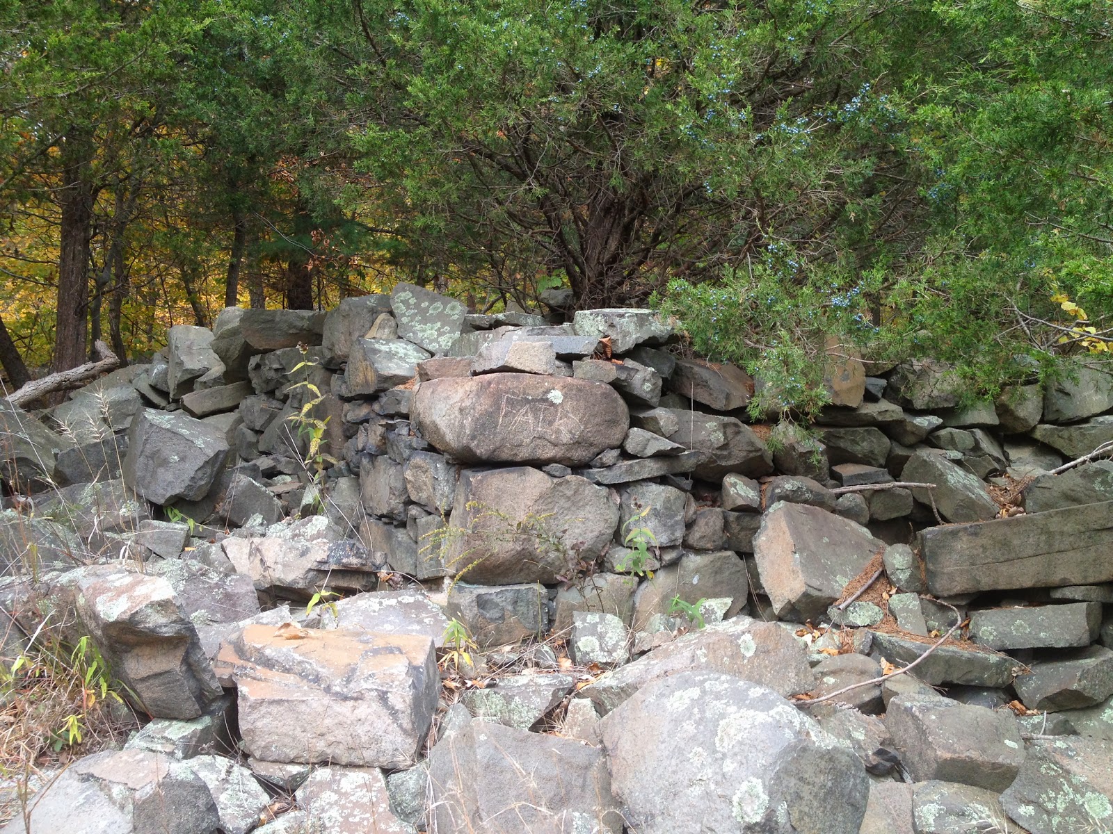
We continued along the road until it ended at a pile of rocks, with some spray painted rock formations. We could see the blue trail blazes from there.  
 
From there, we headed to the right along the trail, to walk back to the northern terminus of the Regicides, at the intersection with the Quinnipiac. 
There was some snow at the trail intersection. 
 Near the intersection, there was a good view. 
From here, we continued back the way we had come, passing by the end of West Shepard, and hiked south. We passed by a view of Farm Brook Pond. 
There was also a good view of New Haven. 
We then had some good view of Lake Watrous. 
We passed by a little stone shed with no roof. 
We had some views of Lake Dawson. 
 
Eventually, we crossed over the Rt 15 tunnel. 
And went by the tunnel's ventilation shaft and emergency exit which was much larger than pictures had led me to believe. 
We passed by Judges Cave which was really more like gaps between rocks than a cave. 
After a walk that skirted along the edge of the cliff, the trail finished behind the pavilion.
 
 There was some beautiful views from the parking area. 

 The sleeping giant...
From here, we headed back along the Blue trail to the Blue/Yellow Westville Feeder Trail. 
After a bit of slipping and sliding down the trail, we arrived at the park entrance where we had parked one car. 
Overall, it was a good hike, though a bit longer than our typical. 

Wednesday, August 27, 2014

Quinnipiac Trail - part 2

This hike occurred on August 2, 2014
Trail Heads: 
370 Brooks Rd, Bethany, CT - This road is a narrow, wooded residential road. There's space for maybe 2 cars on the side of the road near the trail head.

250 Mt Carmel Ave, Hamden, CT - We parked on the side of the road by Sleeping Giant State Park. Street parking is allowed during the weekend; we did this so we could avoid the park's fee. 

Length/Distance: According the Connecticut Walk book, the route between the trail heads on Brooks Rd and the entrance of the Quinnipiac Trail into Sleeping Giant State Park was 4.6 miles. According to my GPS tracking program, our route was 4.89 miles.

Summary: We started from Brooks Rd. The day was overcast; it had rained earlier in the day so underbrush was damp. Less than a mile into the hike, my companion was stung six times by an unidentified insect; most likely, it was a wasp. After treating the stings, we continued on with our hike. Towards the top of a hill, we found Lowbush Blueberries (Vaccinium angustifolium) 
There were a few ripe blueberries to be had. We also found bushes of American Red Raspberries (Rubus idaeus) along the trail. At 1.1 miles, we came to a T with the Quinnipiac and the northmost portion of Regicides Trails.
After a bit more hiking, the trail has a road walk along Paradise Ave; in the future, this is where we'd access the northmost point of the Regicides, given the trail intersection was ~0.6 miles from Paradise Ave. There's also a parking area at the dead-end. 
The trail entered the woods again at the end of the cul-de-sac, fairly quickly leading to a road walk along Old Coach Hwy, Nolan Rd, Shepard Ave, and Rocky Top Rd. We then entered the woods again to the left side of Rocky Top Rd. This took us up and over York Hill. This portion of the trail was relatively overgrown and very noticeably so because of the prickers. There was some nice Staghorn Sumac (Rhys typhina). 
Along this portion of trail, we also saw an old stone chimney and oven. 
The trail emerged onto Kimberly Ave, right down the road from the Quinnipiac York Hill campus with the TD Bank Sports Center. They had some nice Lilacs planted in the area. 
From there, we road walked down West Woods Rd, over Whitney Ave, and then into the woods by Sleeping Giant. The trail lead around Mill River back to Mt Carmel Ave. 
There was a deer in the middle of the path by the river. 
Since we had previously hiked the entirety of the Sleeping Giant Blue Trail/Quinnipiac in years past, that finished our hike. We have two more hikes left to finish the entire Quinnipiac.    

Friday, May 16, 2014

Quinnipiac Trail - part 1

This hike occurred on May 11, 2014
Trail Heads:
102 Chestnut Lane, Hamden, CT - There is parking on the side of the road for 2-3 cars to park off the road. There's also enough space to park along the side of the road.

6 Banton St, North Haven, CT - This parking area is in a dead-end area directly behind a service station on Rt-15. There's quite a lot of parking available. 

Length/Distance: According the Connecticut Walk book, the route between the trail heads on Chestnut Ln and the beginning of the Quinnipiac Trail was 5.4 miles. According to my GPS tracking program, our route was 5.27 miles.

Summary: We began from Chestnut Lane since it had higher elevation and the hike would be all downhill or flat. 
We hiked along the trail until we came to a road.
There was a bit of a road walk along a busy road with poison ivy along the edges but we managed to get to the next portion of trail without incident. 
At the trail entrance into the woods by the road, there was a sign warning that portions of the trail might be impassable but it had no date to indicate how long it had been there.
We decided to press on. The trail wasn't bad for the next mile or so. Then we came to an area where the water crossed the trail and there was no way around. 
We decided, what the hell, we'll ford it. So we went through the water; it came up to our knees. We pressed onward. There was more water. 
And then more water. There was some really cool flowers blooming underneath the surface of the water. 
The amount of water we slogged through was impressive. First there was a few sections where we waded through waist deep water, then later rib deep water. Eventually, there was one place where the water came up to the top of my 6'1" hiking companion's shoulders. I ended up swimming/bobbing across that portion of water. 

It was an adventure, rather like an application to participate in the next Survivor. It seemed Amazon-esque, without the poisonous/highly dangerous creatures to avoid. Though the mosquitoes got progressively worse throughout the hike; by the end, we felt like mosquito buffet tables. There was also knee high poison ivy, practically dripping with urushiol. Perhaps it was the regular dunking in the river but neither me nor my hiking companion developed any urushiol-induced contact dermatitis (poison ivy rash).  

It was not a hike I'm eager to repeat. Thankfully, the rest of the Quinnipiac Trail doesn't parallel the river. 

Wednesday, October 30, 2013

Sleeping Giant - Blue & White

Hike occurred on October 19th, 2013
Trail Head:
Chestnut Lane, Hamden, CT - Parking: We parked on Chestnut Ln, on the far side of Sleeping Giant. There is roadside parking for at least a dozen vehicles.

Length/Distance: 
We completed a loop hike, taking the Blue trail up to the tower and then coming back on the White trail; this was slated to be around 5 miles. According to my GPS tracking program, our route was 5.9 miles, which included a short off-shoot when we missed a trail split. 
Summary: We began our hike at Chestnut Lane. We followed Yellow to Blue and then hiked up Blue to the tower. From the tower, we followed the Tower trail down to Triangle and then followed Triangle to White. We then followed White back to Chestnut Lane. 
We did find some Virginia Creeper (Parthenocissus quinquefolia) that looks tasty (part of the grape family) but is in fact poisonous. 
The trails were fairly busy given that it was a nice day at the tail end of leaf peeping season. The views were delightful; unlike Vermont, Connecticut trees were still in the process of shedding leaves.