Showing posts with label Middletown. Show all posts

Friday, July 5, 2013

Mattabesett Trail - Part 16

This hike occurred on July 5, 2013
Trail heads:
625 Country Club Rd., Middletown, CT - Parking: There is an area to park 2-4 cars off of Country Club Road, though it's like a short paved driveway so to fit 4 cars, you'd be blocking cars from leaving. Look for this sign; it's right by the parking area. We hiked from here.

135 Footit Dr., Middletown, CT - Parking: Footit Dr is a dead end that quickly turns into a dirt road. There are multiple parking areas on this road; look for the first one on the left that has a Red-Blue blaze. Based on the trash (condom wrappers, used condoms, and small plastic baggies), it's a popular trysting and drugging spot.  

Length/Distance: In 2009, this portion of the Mattabesett trail was changed; a landowner who had previously allowed the trail to cross their land withdrew their permission and the trail had to be rerouted. While the New England Trail interactive map was very helpful in regards to parking places and trail directions, it did not provide specific distances for the portions of trail we were completing. According to my GPS tracking program, our route was 3.34 miles. 

Summary: The first stretch of the hike was on-road. We headed out to the left of the parking area on Country Club Road, towards I-91. The markings took us over I-91 and past the Department of Public Safety. 
There were cloth or paper arrows with letters inside the arrow (I think it was NETNST) pretty often; wherever there wasn't a blue blaze, there was an arrow. After passing by Public Safety, the trail turned right onto Bell Street. 
Right before Saw Mill Road, the trail turned left into the woods by a large metal gate. 
 
This area of the trail was very beautiful; it looked out onto Highland Pond. I've lived in Middletown area for over 5 years, biked the roads around this property, and never knew this preserve was here.   
 
There was a section of the trail here that needed some trimming.
We saw a swan out swimming. 
There was a quaint bridge over part of the pond. 
It offered a perfect view of the pond. 
We saw a Great Blue Heron (Ardea herodias) wading in the shallows but he flew away before we could get a good picture. We also heard many American Bullfrogs (Rana [Lithobates] catesbeiana) in the marshy area near the pond. 
We also found some Black Raspberries (Rubus occidentalis) near the marsh. 

The trail emerged onto Atkins Street. By the entrance to the preserve, there was some nice signage and actual paper trail maps.
We hiked up Atkins Street's hill and followed the Blue trail when it turned left into the forest.  


This section of the trail was in a pine forest!
The ground was moist and there were large muddy sections. Some areas had bridges, others didn't. 
The pine trees smelled amazing. 

There was an old foundation of some kind alongside the trail. 
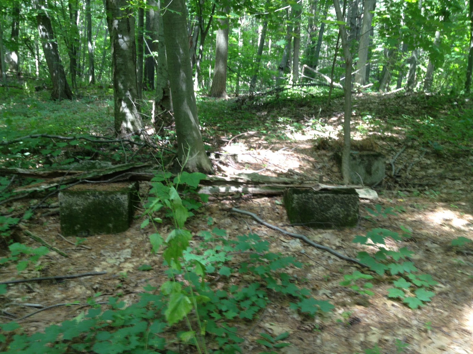
The incline concluded after we found the Red-Blue junction. 
The Red-Blue trail ended back by Footit Drive. 

This hike was fairly short; initially, we'd been thinking of hiking from Country Club Road to Giuffrida Park but given the heat (90 degrees with 65% humidity that felt like 93 degrees), we decided to split the hike. Next time, we'll be hiking from Footit Drive to Giuffrida Park and then from Giuffrida Park to Routes 5 & 15 which will finish the Mattabesett for us! Two more hikes and this trail will be done. 

Mattabesett Trail - Part 15

This hike occurred on July 2, 2013
Trail heads:  
Meriden Rd. (Rt-66) &  Baileyville Rd. (Rt-147), Middlefield, CT - Parking: Right after Meriden Rd. (Rt-66) turns into a divided highway, there is a parking lot on the right hand side that fits 8-12 cars. We hiked from here.

625 Country Club Rd., Middletown, CT - Parking: There is an area to park 2-4 cars off of Country Club Road, though it's like a short paved driveway so to fit 4 cars, you'd be blocking cars from leaving. Look for this sign; it's right by the parking area. 
  
Length/Distance: According to the CT Walk book, the hike was 4.3 miles. According to my GPS tracking program, our route was 4.8 miles. 
Summary: We began our hike from the Rt-66 parking lot. We followed the Blue-Red from the parking area to the intersection with the Blue trail. We continued straight on the Blue trail. 
 The initial climb for this hike started immediately after the junction with the Red-Blue. There were areas you had to scramble up rock sections to continue on the trail. These were still partially wet from the rain the previous day and were a bit slippery. After the initial climb, the trail goes through some nice flat meadows. 
There continued to be some uphill sections before we reached the peak. 
As the path evened out, we saw some cellar spiders/daddy longlegs (Pholcus phalangioides). 
We also saw some violet flowers, most likely Monkey Flowers (Mimulus ringens). 
We also saw a huge dandelion puff the size of a baseball. I'm unsure if it was from an actual dandelion or just another flower I'm not familiar with. 
 After a lot of vegetation, the trail opens onto cliffs. The view was beautiful. In the background of the below picture, you can see the location of our previous hike, Beseck Ridge. 
While it was overcast and darker, the view was still amazing. 
 
We followed the Blue trail along the cliffs. 
We saw more colorful vegetation, such as these White Birch (Betula papyrifera) trees... 
And this Canada Lily (Lilium canadense) flower.
As the path followed the cliff side, there was a section of the trail that had a significant drop. My dog was able to handle it but only barely. 
 There were some sections of the trail with substantial drop offs by the edge of the trail. 
Though the rock formations and views were awesome.


We had a good view of the next mountain on our hike. 
We found a rather terrifying spider clinging to the side of the rocks. Its body was a tiny bit smaller than a quarter. 
After this, the path lead into the forest. 
There was a spot where the Blue trail went to the right but the main path went straight. The intersection was clearly marked though. 
Sometimes the sun found its way through the clouds. 
We had one last cliff side view, right across from a huge quarry. It was incredible to realize each level was big enough to dwarf ginormous dump trucks. 
From here, the trail went through some nice but generic looking forest. 
However, towards the very end of the hike, it got more creepy. Perhaps I've just enjoyed Cabin in the Woods too much but in my defense, the lighting of the day tended towards horror movie lighting. Initially there was just a wood ladder, leaning against a tree.


Then there was the little "no trespassing" sign near the ladder.
Then we started seeing huge piles of old tires in the woods...
And then an ancient, rusted metal sign warning again "do not trespass"...
And another sign warning us to "keep out."
The final crowning glory was this sign (just in case we missed the first three)...
Looking back down the trail, you'd never suspect such wonderfully friendly signs await innocent hikers.
And that walk of terror lead us to the parking area off of Country Club Road! This area would be great for a haunted walk through the woods. It would be so easy to introduce a redneck zombie torture family to unsuspecting visitors.

The weather for the hike was not optimal. It was in the low 80's with 90%+ humidity. The mosquitoes were beyond plentiful; we had applied bug spray prior to the hike but wished we'd brought extra to apply a second (and third) time. Initially it was sunny but quickly became overcast; weather forecast said to expect thunderstorms in the area between 8-10 pm. We did not finish the hike until almost 8:30 pm but managed to avoid precipitation or storms.