 |
| This hike occurred on July 17, 2013 |
960 Orchard Rd., Berlin, CT - Parking: Technically, there isn't any parking though there is space on the side of the road to fit one car off the road.
2190 Chaimberlain Highway, Berlin, CT - Parking: Originally, we were going to park on Victoria Dr where the trail crosses it, as shown on Google Maps. However, it turns out that Victoria Dr is a closed dirt road with large metal gates blocking its entrance. So instead, we ended up parking off of Chaimberlain Highway, by a farm's greenhouses. We saw the above sign indicating the Metacomet trail was accessible from there. So we traveled down past the greenhouses, found the trail head, and hiked from here.
Length/Distance: According the Connecticut Walk book, the route was 1.4 miles. According to my GPS tracking program, our route was 2.8 miles. However, we did travel at least 1/2 mile on the Berlin blue-diamond trail, as well as traveling down Summit Wood Drive for perhaps 1/2 mile.
Summary: We began our hike on the Town of Berlin's blue-diamond trail. The trail crossed by a mucky creek and then began to climb upward.
The blue-diamond trail was very well marked and easy to follow, though we agreed that had we known this parking area lead to a connector trail, we wouldn't have hiked from there. After over half a mile of uphill hiking, the trails met.
We followed the Blue trail from there. It paralleled Summit Wood Dr until right after the power lines.
We had a hard time finding the trail after it crossed under the lines. We eventually found it, on the right hand side.
It was NOT easy to see; the blue blaze had been covered by foliage. Better marking is recommended. As you can see in the picture, there was a dirt track worn into the trail. This continued for a tenth of a mile or two and then the blue trail takes an abrupt left; don't miss it.
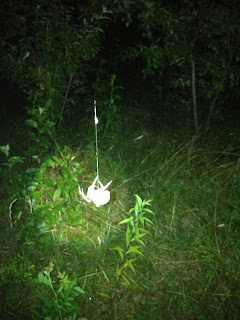
Not long after this, it became too dark to take many pictures. Thanks to previous experiences, we had a few flashlights in our packs. It was a testament to the fact that this section of the trail was well marked in the woods portions (connections between woods and roads not as much). We were able to follow the trail using flashlights which meant that most blazes were within line-of-sight of the next one. We did encounter a number of huge (apricot sized) spiders spinning person-sized webs across the trail.
In general, it was a decent hike. We were hiking later in the day due to a heat advisory and it was cooler in the evening. The blue trail markings were sufficient to find our way, though the entrance into the woods off of Summit Wood left a lot to be desired. It was very frustrating trying to find parking areas; the New England Trail website says there's parking on Summit Wood but there isn't. You can park on the side of the road as it's residential but there is no area near the blue trail that offers parking on the shoulder. For our next hike, we'll be hiking to/from the end of Summit Wood Dr.


No comments:
Post a Comment