Monday, August 19, 2013

Appalachian Trail - part 1

This hike occurred on August 17 & 18, 2013
Trail heads:
8 Old Sharon Rd., Sharon, CT - Parking: We were a bit nervous leaving a car here but there was one space across from an unoccupied house that appeared to be either a weekend/summer house or abandon. The road is dirt and very quiet and we had no problems. 

152 West Cornwall Rd., West Cornwall, CT - Parking: This road crossing had space to park 5-6 cars off the road on gravel.This road is paved and very quiet. 

Length/Distance: According to the CT Walk book and the Appalachian Trail guide, the two sections of trail we completed should have both been 2.3 miles. We did not track our first section (approximate map here) but did track the second and it was 2.73 miles.  

Summary: On the first day, there was a bit of a climb, though there was a very nice view towards the top to serve as a reward. You could see smoke from the nearby Housatonic Meadows State Park
We hiked along to the Caesar Brook campsite. There were three other (most likely thru-) hikers already there, all with hammocks. The campsite had a lot of space for tents and hammocks, as well as a wash station for dishes and a "chum" privy with no walls. Caesar Brook was very nice and you could hear the brook burbling from camp.  

We set up our tent, cooked dinner, and turned in for the night. 
Around midnight, two people barreled into camp with bright flashlights and loudly set up their tent. They were still sleeping when we left.
We were the first ones awake, packed up camp, and were on the trail by 7am. By the brook, there was a foundation from an old house. 
We crossed over a few more streams. 
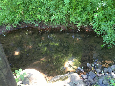
And eventually crossed over a substantial creek. 
Old Cornwall Road was just beyond this creek crossing. 

Overall, it was a good first-time-out backpacking trip. We were only out for dinner and breakfast so we didn't need to pack a lot of food or other supplies. I did determine that the REI two-person tent we own needs to be split between two people to be packed comfortably as it's just shy of 6 pounds. 

Friday, August 16, 2013

Risley Pond Trail

This hike occurred on August 9 & 14, 2013
Trail head: 
365 Lake St., Vernon, CT - Parking: Risley Pond trail has a parking lot with room for over half a dozen cars. 

Length/Distance: According the CT Walk book and the town of Manchester, this lollipop loop trail should be 2.6 miles. According to my GPS tracking program, our route was 3.0 miles. 

Summary: 
The first time we stopped by there, we didn't have time to complete the hike but got some nice pictures of the vegetation growing along the beginning of the trail. There was some Jewelweed (Impatiens capensis).
As well as not yet ripe Blackberries (Rubus fruticosus). 
We also found Bittersweet Nightshade (Solanum dulcamara). It is related, though not closely, to Deadly Nightshade and can be moderately toxic
There was also a Great Burdock (Arctium lappa). 
The second time we visited the park, we hiked the trail. About half of it was in the dark. We did get some beautiful pictures of the lake at night. 


Tuesday, August 13, 2013

Metacomet trail - Part 7


This hike occurred on August 6 & 11, 2013
Trail Heads:
620 Edgewood Rd, Berlin, CT - Parking: On the side of Edgewood Road, there is parking for around half a dozen cars to park off-road. 

650 Southington Rd, Berlin, CT - Parking: On the side of Southington Rd, there's space to park maybe 1-2 cars. There are no signs prohibiting it but it isn't an optimal spot. 

Length/Distance: For the first hike, according the Connecticut Walk book, the route between the trail heads on Edgewood Rd & Southington Rd was 1.4 miles. According to my GPS tracking program, our route on August 6 was 2.35 miles which was a there-and-back road walk. For the second hike, we followed the blue trail from the Edgewood trail head back towards Hubbard Park to find where we lost the trail last week. According to my GPS tracking program, our route on August 11 was 3.9 miles which was a there-and-back hike. 

Summary: The road walk on August 6 was uneventful. We began our backtrack hike on August 11 from Edgewood Rd.
 We went past the gate and up the wide trail. 
There were many bees feasting on wildflowers like purple and white Chicory (Cichorium intybus) and Larger Bur-marigold (Bidens laevis). 


We also saw some Cicada (Cicadidae cicada) holes.
 Across the trail, there was a gigantic spider, carrying a snack sack along with it. Unfortunately, the camera couldn't focus on it properly. 
Initially, we missed this turn off of the trail. The main path continued on and the tree was a bit off the path. 
This portion of trail was entirely uphill. There were sections of loose rock to scrabble over.  
The trail went over the pipeline area and it was quite overgrown. The trail looked like a tick convention (path is dead center of the picture). 
Looking back, it might be difficult to find the trail. You can see the trail marker on the tree in the shadows. 
There was a tiny little stream along the way.
After a bit of climbing, we found the spot where the trail split. The trail was marked but indicated the turn much too early. A tree on the left indicated a turn to the right as the path curved around. I recall thinking whoever marked the trail was a bit overzealous as it was obvious the main path turned. But it so happens that the trail goes straight ahead from the turn marker, while the main path turns to the left.  
And in all fairness, it wasn't much of a path. It was much more "blue trail" though.  
During the August 11 hike, we did see two different Eastern Ratsnakes along the trail sunning themselves; they moved out of our way as we hiked through. Overall, both hikes occurred on beautiful days. It was a relief to finish the August 11 hike so we can begin to hike forward without having to deal with Hubbard park's time table. 

Tuesday, August 6, 2013

Metacomet trail - Part 6

This hike occurred on August 4, 2013
Trail Heads:
West Peak Dr., Meriden, CT Parking: Using the Hubbard Park auto road, we parked one car at the top of the Hanging Hills' West Peak.  

620 Edgewood Rd, Berlin, CT - Parking: On the side of Edgewood Road, there is parking for around half a dozen cars to park off-road. 

Length/Distance: According the Connecticut Walk book, the route was 3.1 miles. According to my GPS tracking program, our route was 5.91 miles, which included many, many non-Blue trail miles.

Summary: We began our hike from West Peak. It was a perfect day; it was in the low 70's, dry, and sunny. Soon after entering the woods, there was a beautiful view. You could see the UConn Health Center in Farmington.
At the feet of Sleeping Giant, you could see the slight shimmer of Long Island Sound. 
There was a fire ring near the peak with what appeared to be two burned pillows. 
From here, the trail entered the woods. We followed the blue trail for a while before we reached a fallen tree and realized that the blue markings had just petered out.
We went back up the trail a little bit and found the many (old) blue markings we'd been following. 
  
 
From this, we were forced to conclude that the trail must be the correct one so we continued, even though the trail was slathered in off-white trail markings. As we suspected, it became evident that the white blazes were covering over blue blazes. 
 We were passed by 6-8 ATVs on this trail. 
Then we came to a wonderful, three-way intersection that confused us to no end. There was blue trail markings covered over by white, indicating the trail turned right (the opposite direction as Edgewood Road).  
There was another tree indicating that the blue trail was indeed the way we had just come, the black/white trail was to the left (our straight), and the white trail went to our left. 
We followed the "blue" trail and found more blue markers leading us to the left. 
We found remnants of a fire ring. 
 
Near here, we saw a black/white marking that had clearly covered over blue. 
We followed the blue markings down a steep incline; the rocks were very unstable and we each nearly fell at least once. 
And then this wonderful trail ended on a purple trail. 
We followed the purple trail to the right; it soon intersected with the black trail. The black trail appeared to head towards Edgewood Rd, while Violet went in the wrong direction. So we followed the black trail. It went directly under the power lines. 
We could see some kind of parking area off of Rt-364. 
The black trail leads you up this. 
Much of the trail was steep and over unstable rock.
 
 
The last bit of the assent took us through a narrow passage. 
 
There was quite a view from the top. 
After this, it got really frustrating. The trail went up and to the right (we needed to go straight but there was no way to do that). We tried going to the left for a bit (unmarked trail), hoping it would straighten out; it didn't and we hiked back to our starting point. We then went to the right, following the black trail. Turns out, it lead us back to that horribly confusing intersection. At this point, we said forget this and, using GPS, tromped into the woods to find our own way. We went through the woods and came upon an old campsite. 
People had left bed rolls and a tent. 
Nearby, there was a tool meant to be dragged behind an ATV to clear out an area for camping. 
The area had been flattened using it. 
 
After thrashing around in the woods for a bit, heading for the road, we saw a gravel road off to our left, under the powerlines. We made our way through some of the harshest prickers we've seen so far (and gave some blood) to get to the road. On the road, we saw some tall purple flowers that could have been Common Lupine (Lupinus polyphyllus) or Lupinus Perennis.
We followed this down to Edgewood Road (going over a small section of someone's private property) and walked maybe 0.8 miles back to the car. 

This was the worst hike so far, in regards to trail markings and final result. In the future, we will have to hike from Edgewood Road back up the blue trail to see where we went wrong and if it was more us getting lost or a poorly marked trail.