Showing posts with label Ragged Mountain Preserve. Show all posts

Tuesday, November 19, 2013

Metacomet trail - Part 9

This hike occurred on October 27, 2013
Trail Heads:
330 Long Bottom Rd., Southington, CT - We parked on Long Bottom Road at Roger's Orchard farm store. There is no roadside parking available at the trail head on Shuttle Meadow Road. 

600 Wigwam Rd., Berlin, CT - We parked on Wigwam Road by Ragged Mountain Preserve. 


Length/Distance: According the Connecticut Walk book, the route between the trail heads on Long Bottom Rd & Ragged Mountain was 3.0 miles. Including a portion of Ragged Mountain's trail system, according to my GPS tracking program, our route was 4.36 miles. 


Summary: We started our hike from Roger's Orchard. We did a road walk for the first half mile or so. From there, we hiked into the woods and up to an overlook of Shuttle Meadow Reservoir. The trail then headed downward towards Ragged Mountain Preserve. The trail intersected with the trail system and we took Blue-Red trail out to Wigwam Rd. 

Thursday, September 19, 2013

Metacomet trail - Part 8

This hike occurred on September 15, 2013
Trail Heads:
650 Southington Rd, Berlin, CT - Parking: On the side of Southington Rd, there's space to park maybe 1-2 cars. There are no signs prohibiting it but it isn't an optimal spot.

Sheldon Rd, Southington, CT - Parking: On the side of Sheldon Rd, there is on-street parking for 8-10 cars. No parking is allowed on Andrews or Carey Streets so expect to park here and walk to the trail head which is about a third of a mile away.

Length/Distance: According the Connecticut Walk book, the route between the trail heads on Carey St & Southington Rd was 1.7 miles, with the distance between Carey St and the junction with the Ragged Mountain trail system marked as 0.5 miles. We hiked from Sheldon Rd to the trail crossing on Carey St, ascended to the Ragged Mountain junction, descended back to Carey St, and then hiked from Carey St to Southington Rd. According to my GPS tracking program, our route was 3.5 miles; this seemed accurate within half a mile or so.

Summary: From Carey St, we turned left towards Ragged Mountain, following the blazes up a driveway. 
We saw some Schreber's Aster (Eurybia schreberi/Aster schreberi) on the trail. 
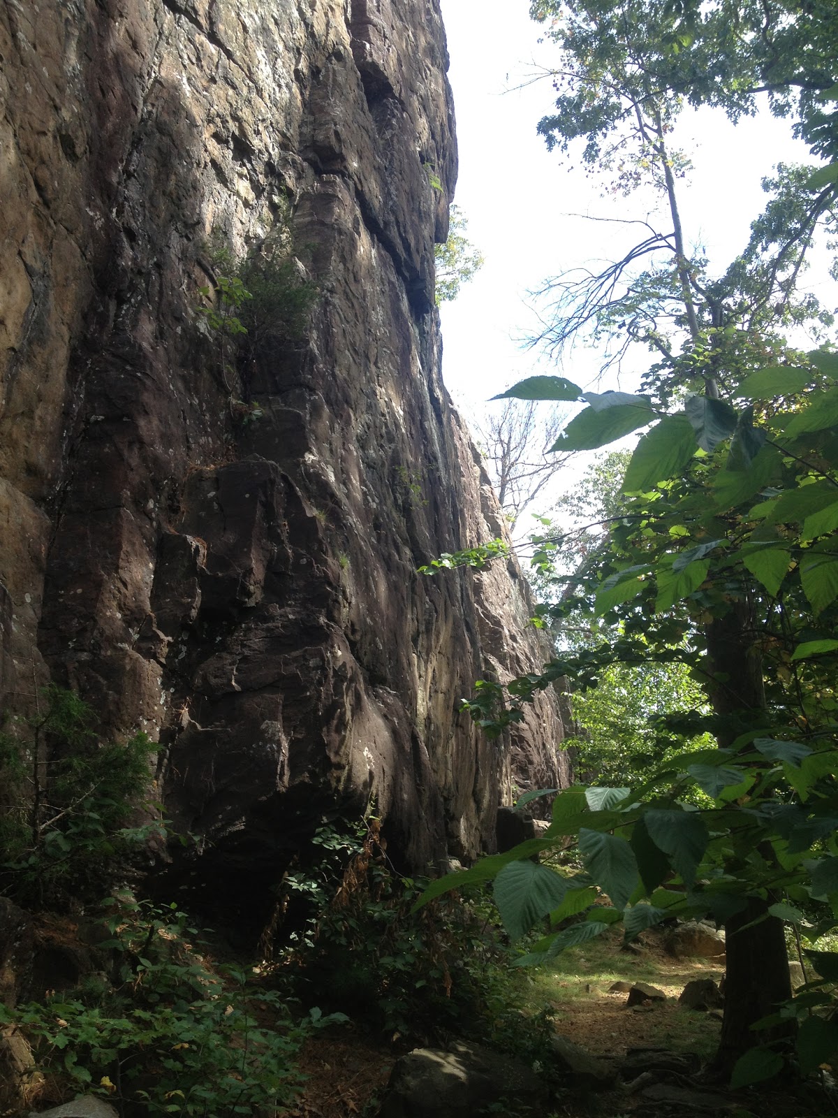
The trail parallels a large boulder/cliff side (I believe it is sometimes used for climbing). 
The trail wrapped around the side of the cliff. The climb up and down required a bit of scrambling. 

At the top of the cliff, the trail meets up with the Ragged Mountain trail system. 
The view from the top was nice and looked back towards West & East Peaks. 
We then scrambled back down to Carey St, traveled along Mill Brook (a private drive), and entered the woods at the end of the drive. Shortly after, there was a wood bridge over a creek. 
From here, the hike did a bit of climbing to ascend Short Mountain though it was lighter than the ascent to Ragged Mountain. There was one or two good viewpoints (as seen at the very top of this blog post). From the top, we worked our way back down to Southington Rd. 

Overall, the hike was short and a good trail to ease back into more intense hiking this fall.  

Thursday, May 31, 2012

Ragged Mountain Preserve

Ragged Mountain
We began this section on April 21, 2012 and finished May 11, 2012
We hiked all of the Red Dot, White Dot, 
Green Dot, Blue-Red, Blue-Yellow, and Blue trails

Trail Head: The trail head for this section is located at West Lane & Wigwam Rd, Kensington, CT. There is a lot of roadside parking located near the trail head. Even on busy days, there has always been parking available. 

Length/Distance: It varies depending on which trails you decide to take. An excellent resource for maps is located on the Berlin Land Trust's website. One hike that we did was Blue-Red to Blue to Blue-Red. That looped hike was approximately 7-8 miles and took us about 3 hours. Here is my route for a shorter hike we did.  


Summary: This area is quite beautiful. There are many different cliffs with gorgeous views of lakes and other mountains. You can see the Hart Lakes, Wassel Reservoir, Meriden and Talcott Mountains, and the UConn Health Center from different lookout points on the Blue trail. However, I would caution anyone hiking there to be wary of poison ivy. I have only just recovered from a bout of poison ivy that I got from hiking at Ragged Mountain after losing the trail (Tecnu and Calagel are great stuff). If you go straight at the trail head to wrap around the right side of the mountain on the Blue-Red, make sure to follow only clearly marked trails. There were a number of trails that seemed to go in the proper direction but were not clearly marked as being any color trail that dead-ended in the middle of a swamp. The maps of the area are helpful but don't appear to have been updated. The color markers have changed on some of the trails and there are many more cleared trails than are shown on the map. Also keep in mind that many streams intersect with the trails and overflow, causing very muddy conditions. Expect to wear boots if it's rained in the past week.   
On the trail, we did see a 5-foot-long Eastern Ratsnake (Pantherophis alleghaniensis) sunning itself on a rock. This variety of snake is quite harmless. A listing of CT snakes with helpful pictures is available here. We also encountered many ticks; this area seems to have a LOT of them, both Dog and Deer ticks.