Showing posts with label Middletown Reservoir. Show all posts

Wednesday, June 20, 2012

Mattabesett Trail - Part 2

This hike occurred on June 11 & 15, 2012

Trail Heads: 
Brooks Rd., Middletown, CT - Parking: right by the Asylum Reservoir Number 2, there is off-street parking for 2 cars. The 2 times we've been here, parking was always available. The Blue trail (going in the southerly direction) is almost directly across the street from the parking spaces/reservoir. The Blue trail (coming from the northerly direction - i.e. Reservoir Rd) is down the road and is on your right-hand side before the road T's with Bear Hill Rd on your left. The trail is a bit overgrown so you might have to search a bit. This is an excellent place to do a loop hike using the Blue-Yellow Reservoir Loop trail and the Blue trail.       
Bear Hill Rd., Middletown, CT - Parking: there is off-street parking for 3-4 cars. The road is also very quiet and has a sizable shoulder so parking isn't an issue at this trail head. This trail head was easy to find.   

Length/Distance: Let's see... from Brooks Rd, following the Blue trail, to Reservoir Rd was approximately 1.2 miles; from Reservoir Rd, following the Blue-Yellow trail, back to Brooks Rd was approximately 1.45 miles. My GPS tracking program said our route was 2.66 miles long. Another day, we came back to hike the section of the trail from Brooks Rd to Bear Hill Rd. Turns out, that route is only 0.24 miles long.   

Summary: We walked down Brooks Rd and located the Blue trail on our right. After tromping through some bushes, we began our hike. 
The beginning of the hike was beautiful. There were fantastic views of the reservoir and it was a gorgeous day. 
After walking for a bit more, we came to a clearing at the top of a ridge and found a gray and orange tent. Now, people aren't allowed to camp out along most of these trails. However, if someone is camping and being responsible in their behavior, I simply would note it and keep going. However, as we continued to hike along a cliff edge, I looked down and noticed 10+ bags of garbage at the bottom of the cliff, clearly thrown off the ledge. After seeing this, I decided that we would notify someone after our hike. 
Cliff (can't really tell from the picture but it drops maybe 30 feet)
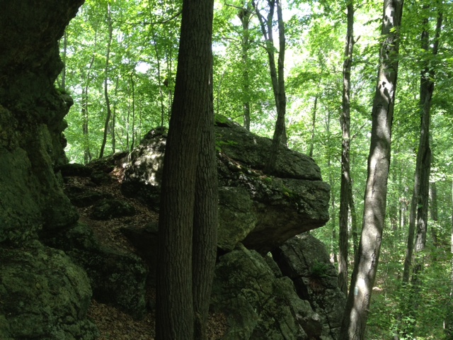
We followed the trail down and around the cliff, gradually working our way back down. There was a pretty cool rock there. 
Not long after, we found ourselves at Reservoir Rd where we found the Blue-Yellow trail and began following it. At the beginning of the trail within view of the road, we saw a moped. A bit further on the trail and we encountered a dirty, unkempt Caucasian male in his 50's collecting firewood with a bottle of alcohol under one arm. He seemed rather unsteady on his feet and appeared to be arguing with himself. We drew the conclusion that this man was more than likely living in the tent and throwing the garbage off the cliff. From there, we followed the Blue-Yellow around the reservoir. It was very pretty. 
There was so mud/muck to trudge through but it was fairly minimal. The trails were marked pretty well and there weren't any side trails to contend with. We didn't see any frogs; we did see chipmunks and squirrels. There also was some very cool milky quartz along the trail. 
At the end of the hike, we did contact the Middletown police's non-emergency number, which was posted by the trail map at the trail head. They sent someone out to talk to us but the police officer seemed rather taken aback by the prospect that he might have to walk to find this person. Give the officer's hesitance, I decided to also contact the Connecticut Forest and Park Association to inform them of the situation. Hopefully, everything got sorted out in the end. 

We completed the small portion of Blue trail from Brooks Rd to Bear Hill Rd another day and there was nothing of note located along that portion of trail. 

Thursday, June 14, 2012

Mattabesett Trail - Part 1

This hike occurred on June 8, 2012 
Trail Heads:
River Rd., Middletown, CT - Parking: The parking area for this trail head is located next to a power plant. You go down River Rd, pass the Kleen Energy entrance on your right and keep going for a bit. You'll see another power plant of some kind on your left. Right before the entrance to that plant, there's parking available on the left side of the road. The trail head has been moved maybe 1/10th of a mile past the plant, as noted on the sign below. This sign was on a telephone pole across the street from the parking area. We parked a car here but started from Reservoir Rd so we never had to find the trail head here. Judging by the difficulty we had trying to get off the trail onto the road, I would say the trail head would be very difficult to find.   
Reservoir Rd., Middletown, CT - Parking: So, apparently you're not supposed to park on this section of the road, since it's state property. If you'd like to hike from/to this location, you should park your car on the side of the road at Cedar Ln & Reservoir Rd and walk in. The blue trail crosses Reservoir Rd twice; the Blue-Yellow Reservoir Loop trail also has one end on Reservoir Rd.      

Length/Distance: We began at Reservoir Rd and hiked towards River Rd. The hike was supposed to be approximately 3.45 miles. My GPS tracking program said that our route was 6.08 miles long. To say it wasn't the hike we expected would be an extreme understatement. 

Summary: This was perhaps the most frustrating hike we have ever been on. The beginning of the hike from Reservoir Rd went well enough. After a sharp climb, we encountered a beautiful view of Asylum Reservoir Number 1.
Not long after that, we went downhill for a bit and encountered a cave which was quite nifty. 
View from trail
View from inside looking out
We hiked for maybe 1/2 mile when we came to an area where the trail split and wasn't marked. We continued down what we thought was the Blue trail. It wasn't the Blue trail. It brought us out to Reservoir Rd and we found the Blue-Yellow and followed it back to the Blue trail. From there, the hike was pleasant enough for a while. There was a delightfully large number of frogs living in this area and we found many healthy specimens living in off-road vehicle created "ponds" (which unfortunately took up much of the path). 
One of the major challenges about this hike was the prolific collection of off-road trails. Because so many people had come through blazing new trails with their motorized bikes and trucks, it was hard to know which trail you were supposed to follow. At the same time, the trail was not clearly marked in many places. Not long after encountering these man-made ponds, the trail paralleled power lines for a while. After curving to the left, the trail quickly became unmarked. We ended up doing a mile-wide loop, following off-roading trails, trying to find the Blue trail. We were unable to find it, despite having GPS, paper and online maps, and the trail's portion of the CT Walk book with explicit directions. Eventually, we decided to utilize our GPS and our paper maps to attempt to find the Blue trail on our own, ignoring any trails. After maybe 100 yards, we located the Blue-blazed trail. However, while the "trail" was now blue-blazed, the trail was not clear. The trail took us through 300 yards of unstable rocks, 6 foot tall brambles with 2 inch prickers, and poison ivy. 
In the midst of all that horror, this beautiful flower was growing
We finally burst out of the underbrush onto an access road underneath the power lines. From this point onward, the trail wasn't difficult to follow, though it took us through another thicket, this time of Tartarian Honeysuckle (Lonicera tatarica) shrubs taller than me. 
However, as we got closer to River Rd, the Blue trail split and went two different directions. We assumed it was to old vs. new trail head. We followed the newer paint. It brought us out at the new trail head which was 1/10th of a mile from our car. The exit from the trail onto the road was very overgrown and had poison ivy growing rampant.     

To say I was aggravated would be an understatement. I did contact the Connecticut Forest & Park Association which is the organization responsible for overseeing the CT Blue trail. They said they would look into remarking that section of the trail. I can only hope they do. But I won't be hiking that section ever again!