Showing posts with label flowers. Show all posts

Sunday, July 15, 2012

Mattabesett Trail - Part 5

This hike occurred on July 12, 2012 
Trail Heads:
Aircraft Rd., Middletown, CT - Parking: To reach this trail head, you'll need to drive past a section of the Cockaponset State Forest. If you came off of Rt 9 and travel towards Pratt and Whitney, the trail head is on your right. The majority of parking here is on the side of the road. Aircraft Rd does have a sizable breakdown lane but cars travel on this road around 50-60 MPH so be very careful if you do park on the road. I found a 1 car space off the road a few hundred feet away from the trail head.

Length/Distance: According to my GPS tracking program, our route was about 3.6 miles. According to the CT Walk books, it was only supposed to be 3.1 miles.  

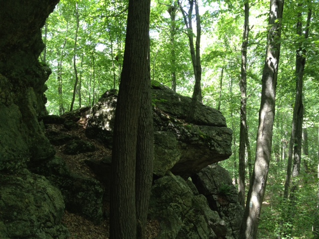
Summary: For this hike, we parked at Aircraft Rd and did a loop hike utilizing the Blue and Blue-Yellow trails. This section of the Blue-Yellow is designated as the Seven Falls Loop trail. Our route went from Aircraft Rd to Saybrook Rd using the Blue trail and then returned to Aircraft Rd using the Blue-Yellow trail. This trail starts with a steep uphill section; the first part of the trail also spends a lot of time weaving over and around sharp cliffs. 
Maybe 1/2 mile into the hike, there's a spot on the trail where you have to climb down 3-4 feet. My dog almost hurt himself jumping down; if I'd had my way, I would have picked him up and lowered him down. You need to be somewhat agile to navigate this section without getting hurt. 
Right after this, there was a very steep section of trail with flat, smooth rock covered with dirt and tiny slippery pebbles. I saw it, reminded myself to be careful, took a step, and fell. I slid down a few feet and my leg got pretty scratched and bruised. My palm wasn't too happy either. So, please take note: be careful. 
After this, we saw a huge boulder that climbers clearly use for bouldering. They'd left chalk marks on some of the biggest handholds. 
A bit up the trail from that there was a cave/rock overhang. There was a lot of spiderwebs hanging from the rock.
 Soon after that, the trail opened up under high voltage power lines. There, we found a lot of fascinating plants! First, there was a cute Charlie Brown Christmas tree.
Then we found wild blackberry plants with ripe fruit on them!
We had some of them and they were very good. 
We also found some wild blueberry plants with ripe fruit. 
We tried some of those as well. They were much sweeter than store-bought ones, though a bit smaller. 
There was some beautiful flowers (which we also saw on our first hike of the Mattabesett). I found they are called Wandlike Bush-clover (Lespedeza intermedia). Also, a fantastic resource for identifying local CT flowers can be seen here; they offer pictures and you can look at flowers by their color. Extremely useful!
There was an odd looking plant that stood about 5 feet tall. Turns out it's Verbascum Thapsus. Apparently, in the western US they call it Cowboy Toilet Paper. I'm not sure how keen I'd be to try that. 
We encountered a plant with berries that we initially couldn't identify nor could we figure it out after scouring the internet for over an hour. I finally found the CT Botanical Society's website and sent them an email with the below picture. They identified it as either Wild Sarsaparilla (Aralia nudicaulis) or Bristly Sarsaparilla (Aralia Hispida). Both of these plants have edible berries.
We also saw some Staghorn Sumac (Rhus typhina) which is not poisonous. The major differences between Staghorn Sumac (SS) and Poison Sumac (PS) (Rhus vernix) are: 1) PS's leaves have smooth edges and are more oval shaped while SS has jagged edges and long frond-like leaves; 2) PS's stalks are smooth while SS has brown/red hairy bristles; 3) PS only grows in swampy wetlands while SS grows in dry, poor quality soil; 4) PS grows only white berries when ripe while SS grows only red berries when ripe. 

Along this section of trail under the power lines, we had to climb down a huge set of boulders. There were a lot of holes and drop offs so we were very careful. My dog could handle it but just barely. 
After this, the trail led back into the woods again. We quickly came to a creek that parallels Saybrook Rd. The water was cool and there were many waterfalls. It was very pretty; it made me want to return on another day to splash in the water. There were sections that were probably 3 feet deep. 
Right around the creek we found 1/2 of an Eastern Bluebird egg shell. It was super cute. 
This is the first time we've made it out of Middletown on the Mattabesett trail!!!
From here, we easily found the Blue-Yellow trail and followed it back towards Aircraft Rd. We crossed under the power lines again and had a beautiful view. 
Right after entering the woods again, we found another 1/2 of an Eastern Bluebird shell.
The rest of the hike was fairly quick and easy. The Seven Falls Loop trail was easier than the main trail. One cool thing we did see was a whole section of the forest covered in Evergreen Woodferns. 
Overall, it was an eventful hike with lots of cool stuff to see! It did convince us that we needed to get in the habit of carrying a small first aid kit with us after my leg was scraped up from my fall and my friend was stung by a wasp on the way back to the car. Ah, fun times! 

Thursday, June 14, 2012

Mattabesett Trail - Part 1

This hike occurred on June 8, 2012 
Trail Heads:
River Rd., Middletown, CT - Parking: The parking area for this trail head is located next to a power plant. You go down River Rd, pass the Kleen Energy entrance on your right and keep going for a bit. You'll see another power plant of some kind on your left. Right before the entrance to that plant, there's parking available on the left side of the road. The trail head has been moved maybe 1/10th of a mile past the plant, as noted on the sign below. This sign was on a telephone pole across the street from the parking area. We parked a car here but started from Reservoir Rd so we never had to find the trail head here. Judging by the difficulty we had trying to get off the trail onto the road, I would say the trail head would be very difficult to find.   
Reservoir Rd., Middletown, CT - Parking: So, apparently you're not supposed to park on this section of the road, since it's state property. If you'd like to hike from/to this location, you should park your car on the side of the road at Cedar Ln & Reservoir Rd and walk in. The blue trail crosses Reservoir Rd twice; the Blue-Yellow Reservoir Loop trail also has one end on Reservoir Rd.      

Length/Distance: We began at Reservoir Rd and hiked towards River Rd. The hike was supposed to be approximately 3.45 miles. My GPS tracking program said that our route was 6.08 miles long. To say it wasn't the hike we expected would be an extreme understatement. 

Summary: This was perhaps the most frustrating hike we have ever been on. The beginning of the hike from Reservoir Rd went well enough. After a sharp climb, we encountered a beautiful view of Asylum Reservoir Number 1.
Not long after that, we went downhill for a bit and encountered a cave which was quite nifty. 
View from trail
View from inside looking out
We hiked for maybe 1/2 mile when we came to an area where the trail split and wasn't marked. We continued down what we thought was the Blue trail. It wasn't the Blue trail. It brought us out to Reservoir Rd and we found the Blue-Yellow and followed it back to the Blue trail. From there, the hike was pleasant enough for a while. There was a delightfully large number of frogs living in this area and we found many healthy specimens living in off-road vehicle created "ponds" (which unfortunately took up much of the path). 
One of the major challenges about this hike was the prolific collection of off-road trails. Because so many people had come through blazing new trails with their motorized bikes and trucks, it was hard to know which trail you were supposed to follow. At the same time, the trail was not clearly marked in many places. Not long after encountering these man-made ponds, the trail paralleled power lines for a while. After curving to the left, the trail quickly became unmarked. We ended up doing a mile-wide loop, following off-roading trails, trying to find the Blue trail. We were unable to find it, despite having GPS, paper and online maps, and the trail's portion of the CT Walk book with explicit directions. Eventually, we decided to utilize our GPS and our paper maps to attempt to find the Blue trail on our own, ignoring any trails. After maybe 100 yards, we located the Blue-blazed trail. However, while the "trail" was now blue-blazed, the trail was not clear. The trail took us through 300 yards of unstable rocks, 6 foot tall brambles with 2 inch prickers, and poison ivy. 
In the midst of all that horror, this beautiful flower was growing
We finally burst out of the underbrush onto an access road underneath the power lines. From this point onward, the trail wasn't difficult to follow, though it took us through another thicket, this time of Tartarian Honeysuckle (Lonicera tatarica) shrubs taller than me. 
However, as we got closer to River Rd, the Blue trail split and went two different directions. We assumed it was to old vs. new trail head. We followed the newer paint. It brought us out at the new trail head which was 1/10th of a mile from our car. The exit from the trail onto the road was very overgrown and had poison ivy growing rampant.     

To say I was aggravated would be an understatement. I did contact the Connecticut Forest & Park Association which is the organization responsible for overseeing the CT Blue trail. They said they would look into remarking that section of the trail. I can only hope they do. But I won't be hiking that section ever again!  


Monday, June 4, 2012

Mountain Laurel vs. Rhododendron

As I was examining my photos from my last hike, I became puzzled as my brain produced two names for the flowering plant I had seen. Was it a Mountain Laurel or a Rhododendron? So I began exploring the interweb. Turns out, they have a lot in common and do resemble each other which explains my confusion. The most obvious differences are:


  1. Leaves. Mt. Laurels have smaller, more delicate leaves. Rhododendron leaves are larger and have a waxy, leathery feel to them. 
  2. Flowers. Mt. Laurels have five-pointed white flowers with some pink highlights and look like tiny bowls. Rhododendron flowers come in many different colors (pink, red, white, etc) and have distinct petals in each flower.   
  3. Bark. Mt. Laurels have ribbed bark that peels. Rhododendron bark is fairly smooth. 

I borrowed this fantastic picture showing the differences from here.