Wednesday, June 20, 2012

Mattabesett Trail - Part 2

This hike occurred on June 11 & 15, 2012

Trail Heads: 
Brooks Rd., Middletown, CT - Parking: right by the Asylum Reservoir Number 2, there is off-street parking for 2 cars. The 2 times we've been here, parking was always available. The Blue trail (going in the southerly direction) is almost directly across the street from the parking spaces/reservoir. The Blue trail (coming from the northerly direction - i.e. Reservoir Rd) is down the road and is on your right-hand side before the road T's with Bear Hill Rd on your left. The trail is a bit overgrown so you might have to search a bit. This is an excellent place to do a loop hike using the Blue-Yellow Reservoir Loop trail and the Blue trail.       
Bear Hill Rd., Middletown, CT - Parking: there is off-street parking for 3-4 cars. The road is also very quiet and has a sizable shoulder so parking isn't an issue at this trail head. This trail head was easy to find.   

Length/Distance: Let's see... from Brooks Rd, following the Blue trail, to Reservoir Rd was approximately 1.2 miles; from Reservoir Rd, following the Blue-Yellow trail, back to Brooks Rd was approximately 1.45 miles. My GPS tracking program said our route was 2.66 miles long. Another day, we came back to hike the section of the trail from Brooks Rd to Bear Hill Rd. Turns out, that route is only 0.24 miles long.   

Summary: We walked down Brooks Rd and located the Blue trail on our right. After tromping through some bushes, we began our hike. 
The beginning of the hike was beautiful. There were fantastic views of the reservoir and it was a gorgeous day. 
After walking for a bit more, we came to a clearing at the top of a ridge and found a gray and orange tent. Now, people aren't allowed to camp out along most of these trails. However, if someone is camping and being responsible in their behavior, I simply would note it and keep going. However, as we continued to hike along a cliff edge, I looked down and noticed 10+ bags of garbage at the bottom of the cliff, clearly thrown off the ledge. After seeing this, I decided that we would notify someone after our hike. 
Cliff (can't really tell from the picture but it drops maybe 30 feet)
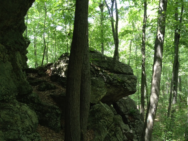
We followed the trail down and around the cliff, gradually working our way back down. There was a pretty cool rock there. 
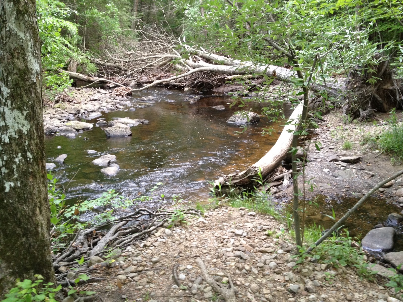
Not long after, we found ourselves at Reservoir Rd where we found the Blue-Yellow trail and began following it. At the beginning of the trail within view of the road, we saw a moped. A bit further on the trail and we encountered a dirty, unkempt Caucasian male in his 50's collecting firewood with a bottle of alcohol under one arm. He seemed rather unsteady on his feet and appeared to be arguing with himself. We drew the conclusion that this man was more than likely living in the tent and throwing the garbage off the cliff. From there, we followed the Blue-Yellow around the reservoir. It was very pretty. 
There was so mud/muck to trudge through but it was fairly minimal. The trails were marked pretty well and there weren't any side trails to contend with. We didn't see any frogs; we did see chipmunks and squirrels. There also was some very cool milky quartz along the trail. 
At the end of the hike, we did contact the Middletown police's non-emergency number, which was posted by the trail map at the trail head. They sent someone out to talk to us but the police officer seemed rather taken aback by the prospect that he might have to walk to find this person. Give the officer's hesitance, I decided to also contact the Connecticut Forest and Park Association to inform them of the situation. Hopefully, everything got sorted out in the end. 

We completed the small portion of Blue trail from Brooks Rd to Bear Hill Rd another day and there was nothing of note located along that portion of trail. 

Thursday, June 14, 2012

Mattabesett Trail - Part 1

This hike occurred on June 8, 2012 
Trail Heads:
River Rd., Middletown, CT - Parking: The parking area for this trail head is located next to a power plant. You go down River Rd, pass the Kleen Energy entrance on your right and keep going for a bit. You'll see another power plant of some kind on your left. Right before the entrance to that plant, there's parking available on the left side of the road. The trail head has been moved maybe 1/10th of a mile past the plant, as noted on the sign below. This sign was on a telephone pole across the street from the parking area. We parked a car here but started from Reservoir Rd so we never had to find the trail head here. Judging by the difficulty we had trying to get off the trail onto the road, I would say the trail head would be very difficult to find.   
Reservoir Rd., Middletown, CT - Parking: So, apparently you're not supposed to park on this section of the road, since it's state property. If you'd like to hike from/to this location, you should park your car on the side of the road at Cedar Ln & Reservoir Rd and walk in. The blue trail crosses Reservoir Rd twice; the Blue-Yellow Reservoir Loop trail also has one end on Reservoir Rd.      

Length/Distance: We began at Reservoir Rd and hiked towards River Rd. The hike was supposed to be approximately 3.45 miles. My GPS tracking program said that our route was 6.08 miles long. To say it wasn't the hike we expected would be an extreme understatement. 

Summary: This was perhaps the most frustrating hike we have ever been on. The beginning of the hike from Reservoir Rd went well enough. After a sharp climb, we encountered a beautiful view of Asylum Reservoir Number 1.
Not long after that, we went downhill for a bit and encountered a cave which was quite nifty. 
View from trail
View from inside looking out
We hiked for maybe 1/2 mile when we came to an area where the trail split and wasn't marked. We continued down what we thought was the Blue trail. It wasn't the Blue trail. It brought us out to Reservoir Rd and we found the Blue-Yellow and followed it back to the Blue trail. From there, the hike was pleasant enough for a while. There was a delightfully large number of frogs living in this area and we found many healthy specimens living in off-road vehicle created "ponds" (which unfortunately took up much of the path). 
One of the major challenges about this hike was the prolific collection of off-road trails. Because so many people had come through blazing new trails with their motorized bikes and trucks, it was hard to know which trail you were supposed to follow. At the same time, the trail was not clearly marked in many places. Not long after encountering these man-made ponds, the trail paralleled power lines for a while. After curving to the left, the trail quickly became unmarked. We ended up doing a mile-wide loop, following off-roading trails, trying to find the Blue trail. We were unable to find it, despite having GPS, paper and online maps, and the trail's portion of the CT Walk book with explicit directions. Eventually, we decided to utilize our GPS and our paper maps to attempt to find the Blue trail on our own, ignoring any trails. After maybe 100 yards, we located the Blue-blazed trail. However, while the "trail" was now blue-blazed, the trail was not clear. The trail took us through 300 yards of unstable rocks, 6 foot tall brambles with 2 inch prickers, and poison ivy. 
In the midst of all that horror, this beautiful flower was growing
We finally burst out of the underbrush onto an access road underneath the power lines. From this point onward, the trail wasn't difficult to follow, though it took us through another thicket, this time of Tartarian Honeysuckle (Lonicera tatarica) shrubs taller than me. 
However, as we got closer to River Rd, the Blue trail split and went two different directions. We assumed it was to old vs. new trail head. We followed the newer paint. It brought us out at the new trail head which was 1/10th of a mile from our car. The exit from the trail onto the road was very overgrown and had poison ivy growing rampant.     

To say I was aggravated would be an understatement. I did contact the Connecticut Forest & Park Association which is the organization responsible for overseeing the CT Blue trail. They said they would look into remarking that section of the trail. I can only hope they do. But I won't be hiking that section ever again!  


Wednesday, June 13, 2012

Chatfield Trail

We began and ended this hike on June 1, 2012 
Trail Heads: 
85 River Rd., Killingworth, CT - Parking: across the street from the trail head, there is parking for 2 cars. The road is very quiet and doesn't see much traffic, though what traffic there is tends to drive very fast. Be wary of drivers not paying attention. 

499 North Branford Rd. (Rt. 80), Killingworth, CT - Parking: at the trail head, there is parking for 3-5 cars, depending on how well people park. This small parking area is on a curve of Rt 80 so be very careful when pulling into and out of this lot. People drive Rt 80 going 65 MPH on a regular basis and the visibility is poor leaving the parking lot. 
Length/Distance: The route we went on was listed as being 3.8 miles. Here is my route. According to GPS, it was actually 4.18 miles long.  

Summary: This was a decent through-hike. We began at Rt 80 and hiked south to River Rd. At first, the scenery wasn't very interesting. After we continued down the trail for a mile or so, we came to a series of rock ledges that the trail snakes down and around. At one point, our dog had to be picked up and carried down a small piece of the trail because the drop was too substantial and there was no way around. 
A bit after that, we came to an access road and the trail follows it for a little bit. As the trail transitioned from road to trail, there was a very nasty area of mud and muck. Make sure to utilize the rocks to cross this area....though if you have a dog, they probably won't. Mine didn't. ^_^  
This is where the trail became awesome! I have a love of cliffs and, more importantly, caves. This trail would have been boring without these but with them... I might actually think about hiking it again. The huge rocks were amazing! 
There was some massive rocks that had broken off from the main cliff and created caves. 

I was like a small child in a candy store!
Growing up, perhaps I read too many survival-oriented fiction novels like My Side of the Mountain, Moccasin Trail, or Sign of the Beaver. But these caves and cliffs made me want to run away into the woods....except for all the mosquitoes in the nearby swamp.   

The trail also takes you right by Deer Lake Camp's Lean-to sites. These were very cool, especially since it was early enough in the season that it wasn't milling with small children. Later in the season, it might not be so quiet. I believe Deer Lake also takes their campers for hikes so this trail might see more foot traffic during summer camp sessions.    

On the hike, we saw some frogs, millipedes, and birds. We also saw a lot of Mountain Laurel. Towards the end of the trail, there was a Mountain Laurel forest where the trail walked through this enchanting archway made entirely of Mountain Laurels. It was quiet and mysterious, with the sound of a bubbling brook in the background. 

One other thing to note: near the end of the trail close to River Rd., there was a lot of barbed wire near the trail, between the trail and the river. Be careful and if you do get scratched, make sure you're up on your tetanus shot (booster shot every 10 years). As far as blue marks go, this trail was pretty straightforward. At the very beginning of the trail, it was somewhat difficult to find the blue trail, as the main trail is a shortcut/side trail. There weren't any issues with staying on the trail.    

Monday, June 4, 2012

Trail Safety

Things to Know about Ticks

From a young age, I've always had an interest in wilderness survival. I have some small amount of practical knowledge from my years of reading survival books as a child. True wilderness survival training takes much more than being an armchair general. It takes an intense amount of work, time, and physical fitness. Thankfully, most of us will never encounter a time that we need that kind of training (especially while doing through-hiking in CT). All of us carry on the trail the one thing we need to get help: a cell phone. Most places in CT have cell service of one kind or another. This would probably be a good time to say that if you don't carry a cell phone with you, you really should. Even if you leave it turned off during the hike, it's always good to have a method to call for help if needed. You never know what could happen. Each year there are at least a handful of news clippings about people wandering off the trail and needing park rangers to come rescue them. While embarrassing, it's a whole lot better than wandering around in the dark looking for the trail and falling off a cliff. Don't be a hiking fatality, please. 


However, beyond more drastic things like wilderness survival, I think there is some information that everyone who lives in New England should know: basic information about ticks. Since I grew up here in CT, ticks and Lyme disease were an accepted part of life. I spent a lot of time in the woods and have had more tick bites than I can remember. I've had Lyme disease at least once and everyone in my family has as well. I also know a number of people whose lives have been permanently altered by the disease when it wasn't caught quickly enough and had symptoms that continued long after the initial round of antibiotics. At the same time, ticks are simply a part of life. If we integrate certain strategies into our lives, we significantly decrease the risk of acquiring Lyme disease.  


Prevention

  1. When outdoors (especially while hiking or in wooded/grassy areas), wear bug spray with DEET [20% or more]. I really don't like to wear DEET bug spray for mosquito prevention; I hate the smell and taste (it always seems to get in my mouth). What I do is spray my upper body with a plant-based repellent and my lower body with DEET, since I pick up most of my ticks by brushing against grass or plants.
  2. Dress in "tick-aware" clothing. This could mean wearing light-colored clothing to make it easier to spot ticks crawling on you or wearing pants and long-sleeve shirts. It can also include wearing a hat and/or putting your hair up to make it harder for ticks to latch on.
  3. During outdoor activities, be aware. If you feel something crawling on you, check it out. It might be your imagination or it might be a tick. If it is a tick, you can either kill it or flick it off.  
  4. After being outdoors/hiking, go home and shower. This will help with both ticks and poison ivy. Also wash the clothes you wore; putting your clothes in the dryer on high heat for 60 minutes will kill any ticks that might have been on your clothes.
  5. After being outdoors/hiking, do a body check. After showering, you should check your whole body; hair, armpits, groin, backs of knees, and chest seem to be favorite places for ticks. They like warm and creased areas. If possible, have someone else check the places you can't see. There are even country music songs about it.
  6. Know what they look like. There are two types of ticks common in CT. One is the Dog tick and is about the size of an apple seed. The other is the Deer tick and is about the size of a sesame seed. The smaller, sneakier Deer tick is most likely to be a carrier for Lyme.   

Tick bites

If you do find a tick, don't panic. If the tick has been attached for less than 36-48 hours, your odds of getting Lyme from the tick bite is microscopic. Ticks cannot transmit anything to you until it has been attached for about 2 days. So the best way to prevent Lyme is to be aware of ticks and check yourself regularly. So if you do have a tick attached, here's what you do:
  1. Don't panic (grab your towel. It might help).
  2. Find tweezers. The best type are fine-tipped with no ridges.
  3. Grasp the tick as close to your skin as you can. This will help remove the entire tick at once. If you grab too high, it might leave behind its mouth. DON'T: twist, jerk, or squeeze the tick, cover the tick with petroleum jelly, douse it with gasoline/kerosene, or try to light it on fire. This will make the tick more likely to "throw up" everything in its system, increasing your risk for Lyme.  
  4. Gently and steadily pull the tick straight up. This should remove the tick from your skin. 
  5. Dispose of the tick. This could include flushing it down the toilet (might not kill it) or dousing it with some alcohol to kill it and then flushing it.  
  6. Clean up. Wash the area with soap and warm water or use some kind of antiseptic like rubbing alcohol or first-aid wash like Bactine. If the tick did leave behind its mouth, attempt to remove it with the tweezers. If this is unsuccessful, don't stress it. Let your skin heal on its own; it will expel the mouth as it heals.   
  7. Wait/watch. At this point, the best thing you can do is wait. You can write down the day and location of your tick bite for future reference if you'd like. You should be especially aware of unusual fatigue, aches and pain, headaches, fever, and rashes. Around 80-90% of people with Lyme disease have a target-like rash surrounding the bite called erythema migrans. If you begin experiencing any of these symptoms or have a rash, see a doctor immediately. It isn't really ER-worthy but if it's after hours and your doctor is unavailable, check out your nearest walk-in clinic.  
Resources


Mountain Laurel vs. Rhododendron

As I was examining my photos from my last hike, I became puzzled as my brain produced two names for the flowering plant I had seen. Was it a Mountain Laurel or a Rhododendron? So I began exploring the interweb. Turns out, they have a lot in common and do resemble each other which explains my confusion. The most obvious differences are:


  1. Leaves. Mt. Laurels have smaller, more delicate leaves. Rhododendron leaves are larger and have a waxy, leathery feel to them. 
  2. Flowers. Mt. Laurels have five-pointed white flowers with some pink highlights and look like tiny bowls. Rhododendron flowers come in many different colors (pink, red, white, etc) and have distinct petals in each flower.   
  3. Bark. Mt. Laurels have ribbed bark that peels. Rhododendron bark is fairly smooth. 

I borrowed this fantastic picture showing the differences from here