Wednesday, August 19, 2015

NH/ME AT section hike, day 9

Start: Spaulding Mountain Lean-to
End: Stratton Motel
Mileage: 13.5

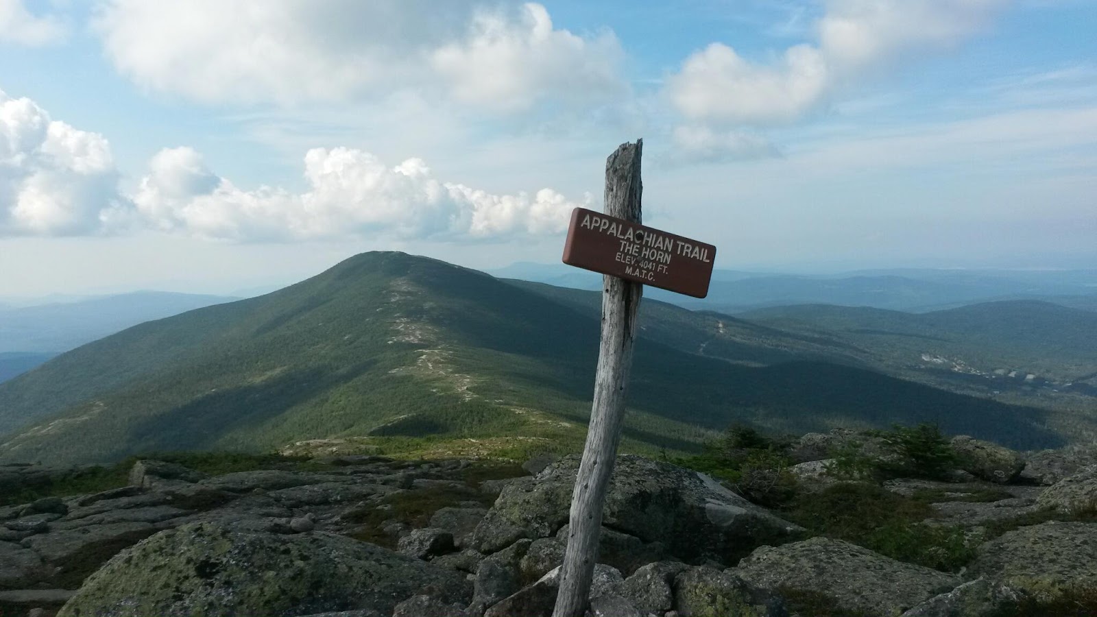
We started out from the lean-to around 6:45am. We climbed over Spaulding Mountain (4,000'), Sugarloaf (3,540'), and then down to South Branch Carrabbasett River (2,100'). From there, we climbed South (4,040') and North (4,228') Crocker Mountains. After that, it was ~5 miles downhill to Maine 27.

We were able to get a ride into town with a trail angel who dropped us off at the Stratton Motel. The new owner, Shane, wasn't at the motel when we showed up but we made ourselves comfortable at the hostel. We ate some food from the small grocery store across the street and showered. Once Shane showed up, we were let into a motel room, which we were all sharing. We ate a hearty dinner at the White Wolf Inn and then hung out in the room until bedtime.

I'm glad for the miles I've done but my body is weary and ready to go home.

NH/ME AT section hike, day 8

Start: Piazza Rock Lean-to
End: Spaulding Mountain Lean-to
Mileage: 16.9

Today, we did the most miles we've done in a day so far. They weren't easy miles either.

We left the shelter aeound 7:15am. We climbed from Piazza Rock Lean-to  (2,080') to Saddleback Mountain (4,120') down into a dip and then up to the Horn (4,020'). We got a good trail family picture on Saddleback's summit with all four of us. We then went down past Reddington Stream Campsite (rumored to have giardia [sp] in the water source) (3,170') up to Saddleback Junior (3,655'). We stopped at Poplar Ridge Lean-to for lunch and much needed water, as we skipped over Reddington and it was the first water source since Piazza.

From there, it was down to Orbeton stream (1,550'). We spent some time there, as the water was cool and the stream had some deep pools to swim in. From there, it was up Lone Mountain  (3,260'). We made it to Spaulding Mountain Lean-to by 5:45pm and there was once again space for all four of us in the lean-to.

Tomorrow, it's 13.5 miles to Maine 27 and Stratton! It's been an adventure, over what I hear is the harshest section of sustained difficult terrain on the Appalachian Trail but me and my knees are ready to go home!

Tuesday, August 18, 2015

NH/ME AT section hike, day 7

Start: Sabbath Day Pond Lean-to
End: Piazza Rock Lean-to
Mileage: 11.2

Today, we started around 7am from the Sabbath Day Pond Lean-to. We had a lot of fairly flat miles today as we went around Little Swift River Pond and South Pond.

We arrived at Maine 4 at 11am; within 10 minutes, a shuttle driven by Stacy, one of the owners of the Farmhouse Inn, stopped and asked us if we'd like a ride into town. She kindly brought us into town, giving us the lay of the land. We had Thai food for lunch, followed by ice cream. We resupplied at the IGA and then the hostel provided us with a free shuttle back to the hostel.

There, we did laundry and some of us showered. The hostel had a lovely set-up, with beds for ~30 guests, with two kitchens and many living room areas. There were multiple TVs with DVD players and a large movie collection. There were plenty of power strips and charging stations. They also had a nice little store with hiking supplies and food stuffs.

We spent the afternoon there, getting a ride back to the trail head at 7pm. We arrived at Piazza Rock Lean-to at 7:45pm and found only Shadow at the lean-to. She was at Sabbath Day Pond Lean-to yesterday evening as well. We have plenty of room in the shelter tonight!

Tomorrow, it's on to Saddleback Mountain and the Horn. ~30 miles to Stratton from here. I expect to be into town by Wednesday night or Thursday morning.

Monday, August 17, 2015

NH/ME AT section hike, day 6

Start: Beyond Old Blue Mountain Summit
End: Sabbath Day Pond Lean-to
Mileage: ~12.6 (+1.2 walking to sandy beach)

I woke up this morning around 6:15am and took my time getting packed up. Backtrack and Stretch came by around 7:45am, expecting Towanda to be with me. It turns out she'd followed me off the mountain the night before but hadn't seen my campsite. We met up with her at Bemis Mountain Lean-to amd continued on together.

Today, we climbed Bemis Range (3,580'), down to Bemis Stream (1,495'), and then around Moxie Pond (2,400'), and Long Pond  (2,330'). At Maine 17, Stretch had friends meet up with her and bring sandwiches for all of us! After we settled in at the shelter, we went swimming down at the pond's beautiful sandy beach

Overall, it was an easier day than the ones we've had so far. Tomorrow, we're hiking to Rangeley to get a resupply and then on to Piazza Rock Lean-to for the night. From Rangeley, it's 32.2 miles to Stratton! I expect to be in Stratton by Thursday at the latest.

Sunday, August 16, 2015

NH/ME AT section hike, day 5

Start: Pine Ellis Hiker Lodge, Andover
End: camping beyond Old Blue Mountain
Mileage: ~14.4

Today, we started our day at the hostel. We got a shuttle out to the trail head and got on the trail by 7:15am.

We hiked up Wyman Mountain (2,920'), down into Sawyer Notch (1,095'), up over Moody Mountain (2,440'), down to South Arm Road (1,410'), and then up Old Blue Mountain (3,600').

We arrived at the summit of Old Blue by ~4pm. The companions I was traveling with wanted to stay the night at the summit and camp out under a tarp. Due to a number of reasons, I decided I'd rather spend the night below the tree line. I hung out with them at the summit until 5:45pm and then went ~1.5 miles to the first water source, where I found a previously used camping spot.

I quickly set up my tent as I could hear thunder in the distance. I put myself and my things inside just in time to avoid a massive downpour. I enjoyed a relaxed dinner and dessert (Flipz dark chocolate pretzels and a homemade woopie pie - delicious) in my tent. Tomorrow morning, I'll be waiting for my companions to hike by so I can join them. Which means I can sleep in for a bit tomorrow!

Saturday, August 15, 2015

NH/ME AT section hike, day 4

Start: Frye Notch Lean-to
End: East B Hill Road, Pine Ellis Hiker Lodge
Mileage: 4.5

Today, we got up at 6:15am and headed out by 7:30am. We all hiked to the road and got there by 9:45. We then spent the next 30 minutes trying to get a ride. We ended up flagging down someone headed the opposite way to make the phone call to the hostel for us once they got service. We got into the hostel by 11am and they just had enough room for us in the bunkhouse. We then spent the rest of the day relaxing, doing laundry, eating food, and resupplying. We celebrated Backtrack's birthday with time in town, a few beers, and a drinking game.

Friday, August 14, 2015

NH/ME AT section hike, day 3

Start: Full Goose Shelter
End: Frye Notch Lean-to
Mileage: 15.5

So the original plan for the day was to see how we felt and either go 12.0 to Baldpate Lean-to or the 15.5 to Frye Notch Lean-to. Towanda started a few minutes after me but needed to go back for her rain jacket so I didn't see her until maybe 11am after I left the shelter at 6:45am. We hiked together until we hit Maine 26, when we met up with Stretch, who is a thru hiker who stayed at Full Goose last night. All three of us agreed we were exhausted and would stay at Baldpate Lean-to. Towanda took the lead after the road crossing, heading for the shelter. Unfortunately, she missed the sign and ended up over the next large mountain before realized the mistake. She ended up continuing on the Frye Notch Lean-to. Stretch and I were confused;we had dinner at the shelter and decided to push on to Frye Notch. We made the two peaks by 7:15pm and hoped to make the shelter by 8pm. Unfortunately, we thought we'd missed the side trail to the shelter so we ended up backtracking quite a ways and then had to turn back around again and continue onward. We made the shelter by 9pm. Thankfully, there was just enough space in the shelter for us.

Today, we hiked over Fulling Mill Mountain (3,395'), through Mahoosuc Notch, up Mahoosuc Arm (3,770'), Old Speck [just shy of peak] (3,985'), Baldpate Mountain West Peak (3,662'), and Baldpate Mountain East Peak (3,810'). 

On my way down Fulling Mill Mountain, I fell quite hard. There were two folks watching and they were frightened for me. I was surprisingly alright, despite slipping on a log ladder and plummeting ~15 feet down into a crevasse with a sharp rock ridge sticking up in it. I strained my knee and bruised my leg but overall, it turned out shockingly well!

NH/ME AT section hike, day 2

Start: Gentian Pond Shelter
End: Full Goose Shelter
Mileage: 9.6

We started out at 6:45am from the shelter; it was raining when we left though it stopped within a few hours. We ended at the shelter by 3:15pm. We were both tired and decided we'd rather do the Notch tomorrow morning when we're fresh. Time at the shelter also gave us time to set our clothes out to dry.

Today's mileage was rough. There was a lot of steep, wet downhill rocky sections between mountains that were extremely slippery and dangerous. And then the uphill portions were also wet which added difficulty. We hiked up Mt Success (3,565'), passed over the NH-ME state line, hiked up Mt Carlos (3,565'), Goose Eye Mountain East Peak (3,790'), and Goose Eye Mountain North Peak (3,675').

NH/ME AT section hike, day 1

Start: Gorham/US-2
End: Gentian Pond Shelter
Mileage: 11.8

I met up with Beth/Towanda at the White Mountains hostel around 12:30pm. We were out on the trail headed north by 1pm. We hiked until 7:30pm to reach a shelter. It poured buckets of rain until the last hour or two of our hike. We climbed up Mt Hayes (2,555'), Cascade Mountain (2,631'), and Wockett Ledge (2,780'). We also passed by Moss Pond.

Thankfully, the shelter had space. Since the rain had stopped, some hikers had moved to camp outside since the shelter was crowded. Towanda and I found space to sleep for the night. Tomorrow, we'll head into ME and perhaps Mahoosuc Notch, often called the toughest mile on the AT.